Current Capabilities
- CRUCIAL funded in response to ESA ITT ESRIN/AO/1-6827/11/I-NB, to investigate the application of CryoSat-2 data over inland water with a forward-look component to the future Sentinel-3 mission.
- CryoSat's primary instrument is SIRAL (SAR Interferometric Radar Altimeter). SIRAL operates in one of three modes; Low Resolution Mode(LRM), Synthetic Aperture Radar(SAR) and Interferometric Synthetic Aperture Radar(SARIN).
- Expertise in satellite radar altimetry, analysis and generation of inland water heights from Level 1A waveform data and river modelling.
- The Earth’s land surface is, in general, a relatively poor reflector of Ku band energy, with the exceptions of inland water, salar and ice surfaces.
- Research with EnviSat Burst Echoes has shown that substantial high frequency information content is present at short spatial scales as the small bright reflecting patch at nadir is able to dominate the returned echo. This effect is most strongly seen with inland water.
Cryosat-2 SAR and LRM Mode
- Previous satellite radar altimeters lost significant amounts of information due to onboard echo averaging. The high along-track sampling of Cryosat-2 altimeter in SAR mode offers the opportunity to recover high frequency signals over much of the Earth’s land surface.
- This is constrained by the availability of SAR Full Bit Rate (FBR) over land as most land/ocean surfaces are tracked in conventional LRM mode.
- Selected SAR (red) and LRM (green) tracks are shown in Fig. 1 (global); Fig. 2 (Amazon Basin); Fig 3. (Mekong); Fig. 4 (Lake Malawi).
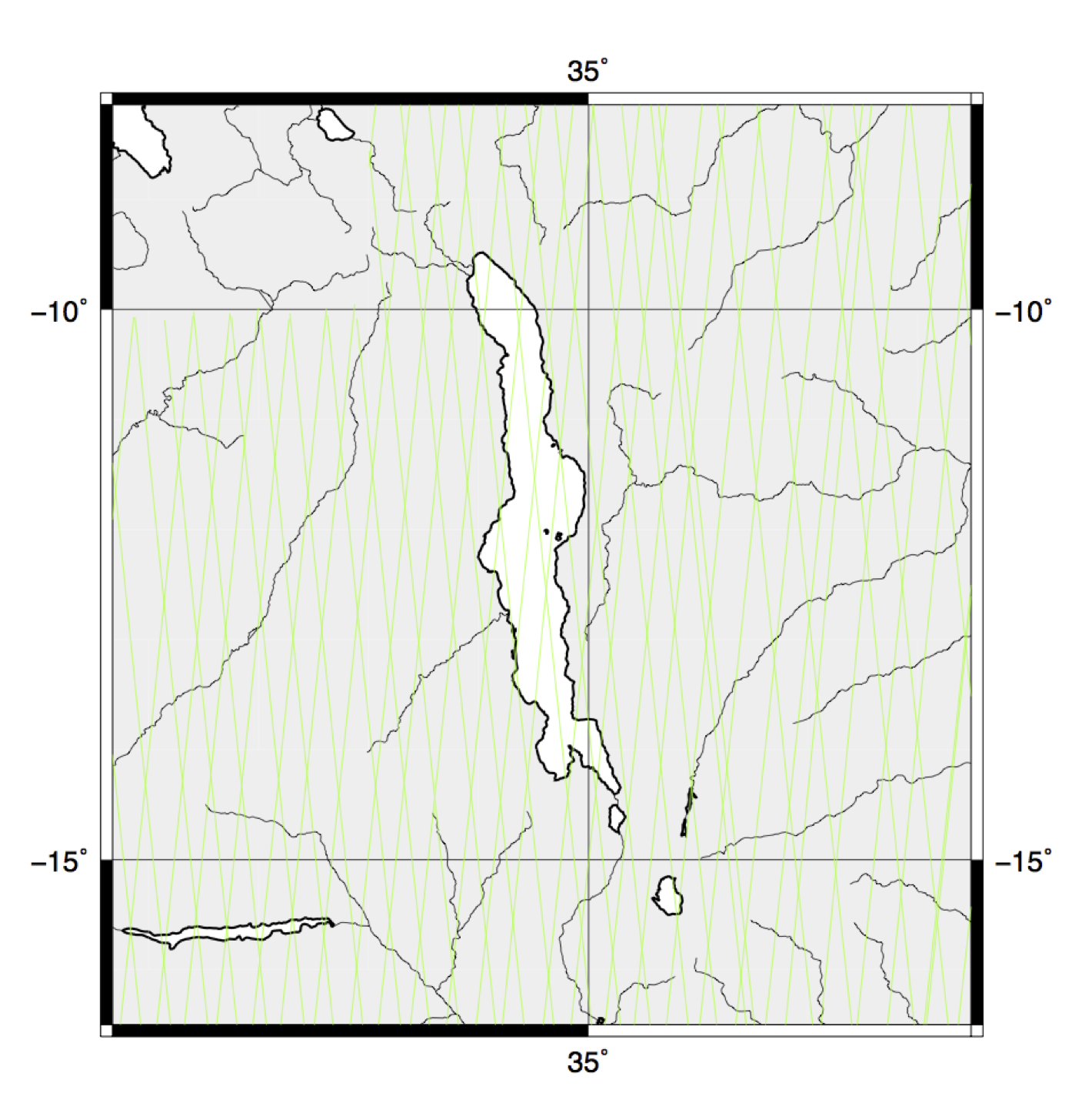
Figure 4. As Fig. 2 for Lake Malawi
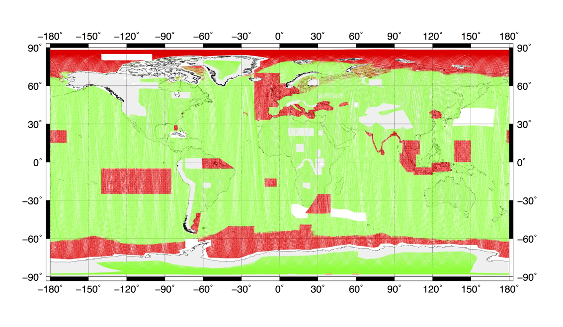
Figure 1. Three months of Cryosat2 Data(Green - LRM, Red - SAR)
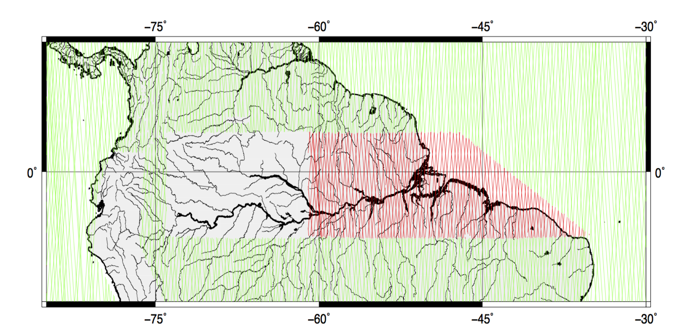
Figure 2. Amazon Basin: LRM (green), SAR (red) and SARIN(blanks) tracks
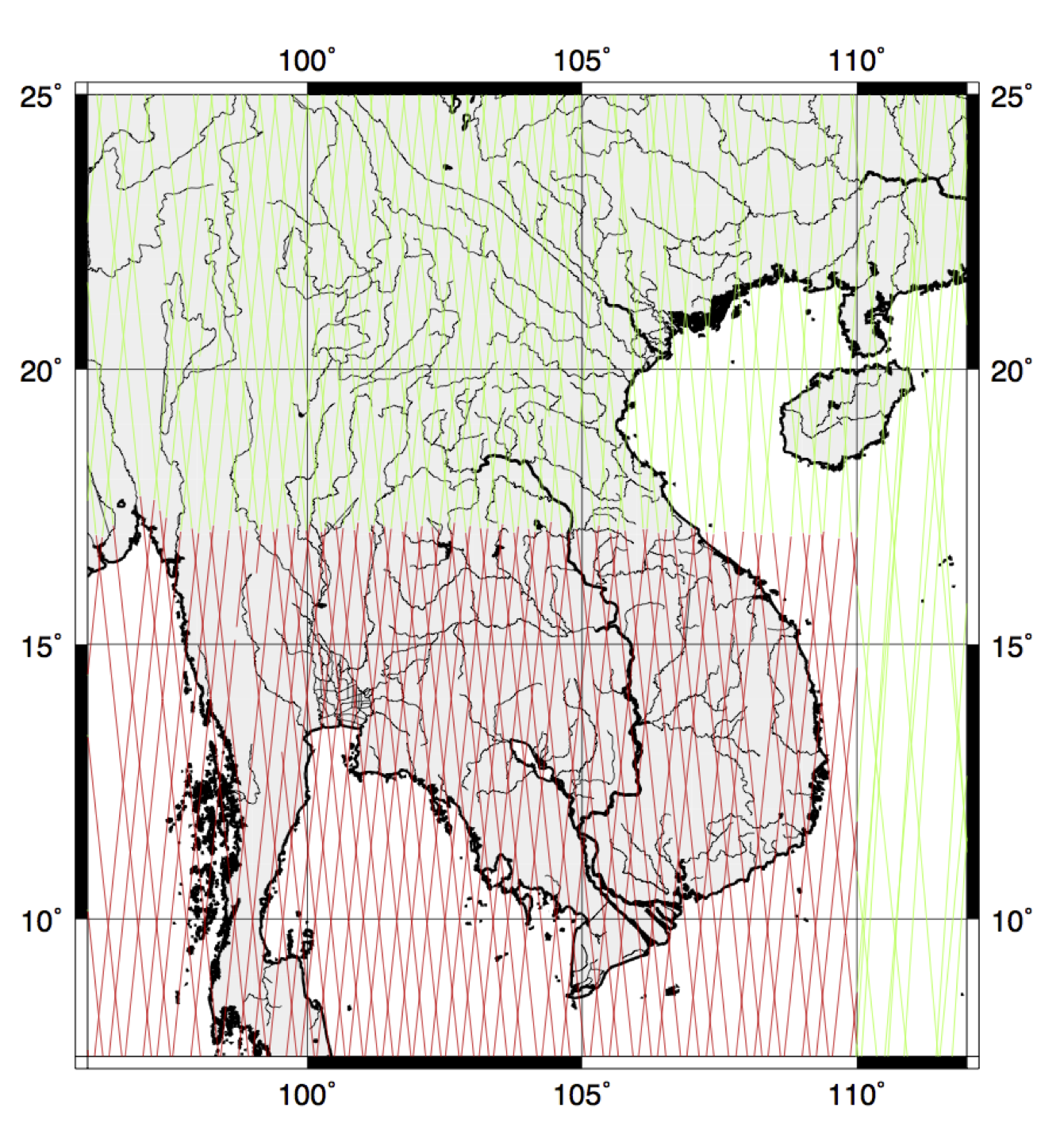
Figure 3. As Fig. 2 for Mekong